Shelter Maps
Find shelter. Instantly.
Finds the closest underground places and official shelter sites in six countries, with live distance, one tap to navigate, and data that works offline. Free on every platform, with no tracking.
Live on Google Play and the web, iPhone coming soon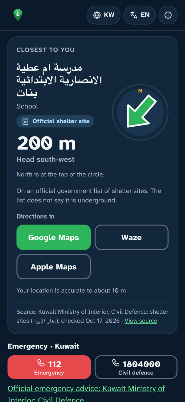
- iPhone
- Android
- Web
In an emergency nobody wants a menu. Shelter Maps opens on one answer: the closest place to take cover, how far away it is and in which direction.
It covers the UAE, Saudi Arabia, Kuwait, Jordan, Qatar and Bahrain, and labels every place by where it comes from: official shelter sites from a government list, or underground places from OpenStreetMap. One tap opens directions in Google Maps, Waze or Apple Maps, and all data is stored on the phone, so it keeps working without internet.
Shelter Maps is a community project: free on iPhone, Android and the web, available in six languages, with no profit and no tracking.
- Status
- Live on Google Play and the web, iPhone coming soon
- Platforms
- iPhone, Android, Web
- Languages
- Six languages
- Disciplines
- Apps and websitesNavigation and geolocation
- Link
- sheltermaps.com
What it does
Nearest shelter, instantly
Live distance and direction to the closest place the moment the app opens.
Six countries on one map
Underground metro stations and car parks, and official shelter sites, each with its source.
One-tap navigation
Directions open in Google Maps, Waze or Apple Maps with a single tap.
Works offline
All data is stored on the device. No internet connection is needed.
Six languages
Residents and visitors can use it in their own language.
Free, with no tracking
A community project with no profit and no tracking, free on every platform.